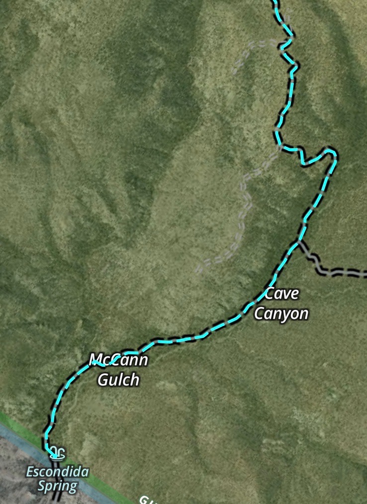
For all intents and purposes, Cave Creek is at the end of the road when you take a drive on FR-157 (aka North Percha Road and in some sources 4088N). On the 30th I went with others to Escondida Spring. Starting at NM-152 we turned north on FR-157, drove through private land to the USDA Forest Service managed land, continued to North Percha where we crossed some in-holdings, crossed the creek, journeyed past Bald Hill, and then into Cave Creek Canyon. Escondida Spring is as far as you can go on this road without entering State Trust lands. All of the streams and stream crossings we encountered were dry (ignoring a short section in Carbonate Creek just upstream from the ‘waterfall’). The map below shows a portion of the route (the area near Bald Hill is at the top of the map).

I recorded a video of the section of the route shown in the map below. The video may be viewed at this link. It has been added to “The Roads of the Black Range” video gallery and it is embedded below.
The raw footage for this video was recorded in a 360 degree format. A short clip of 360 degree video may be viewed at this clip. This clip is embedded below.
Frankly, I am not sure where Escondida Spring is, the Lat/Long (decimal) coordinates are 33.01257,-107.69337, but I could not find a spring - unless it is what was spotted on a hillside in the area (photos below).


I especially liked photographing this bit of H2O. Temperatures have been below freezing at nights for quite some time and the water has frozen to ice. It looks like a slow shutter speed image of a waterfall to me, that glossing over of detail that some like, only it is the water which is slow - well, because it is ice.
If anyone can educate me about Escondida Spring I would appreciate the information. Thanks.
-Bob Barnes, Hillsboro